02 - Lac Blanc from the Col des Montets
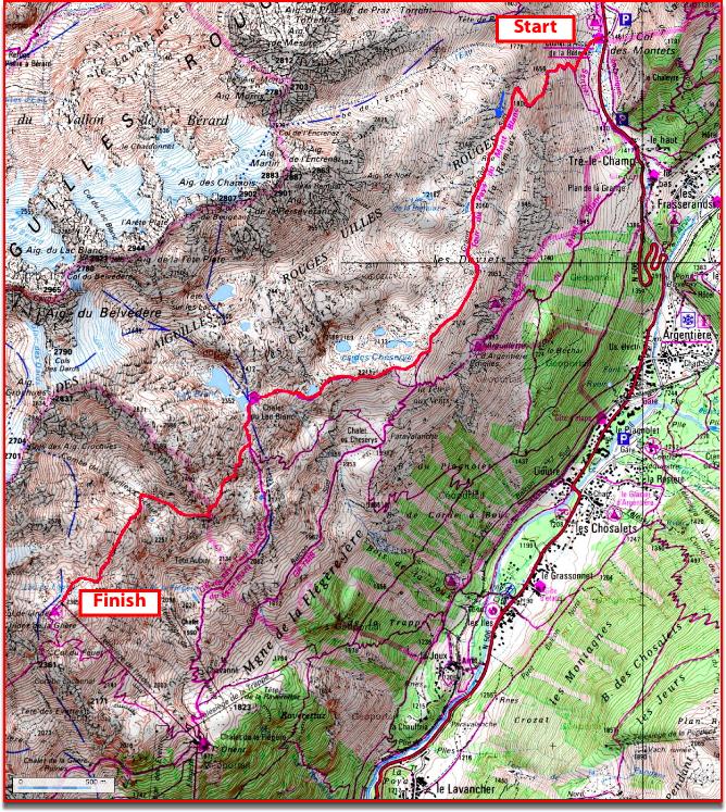
There are many routes up to Lac Blanc. It is also very busy. The proposed hike is a less used crossing, quieter and away from the crowd, starting from the Col des Montets parking lot.
A bus allows you to get to the Col des Montets between late June and early September. It leaves at 9.00 am from the Place du Mont-Blanc in Chamonix, and arrives at 9.30 am at the Col des Montets.
The return is made by the Index chairlift and la Flégère cable car. The best way is to park your car at Les Praz, at La Flégère parking, and buy your return ticket before the hike and catch the bus at 9.00 am from Les Praz / La Flégère bus stop that drops you at 9.30 am at the Col des Montets.
At the Col des Montets (1,461 m), take the trailhead behind the Botanical reception chalet of the Aiguilles Rouges reserve, the trail rises quickly in zigzags..
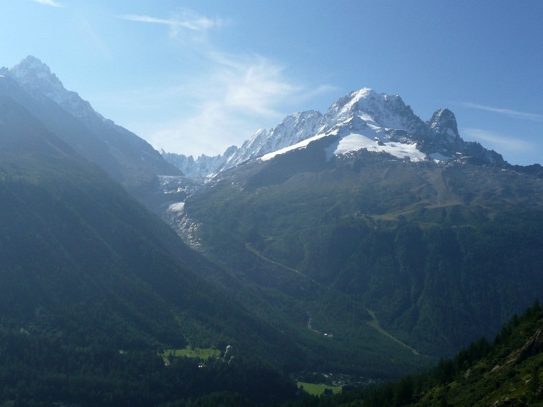
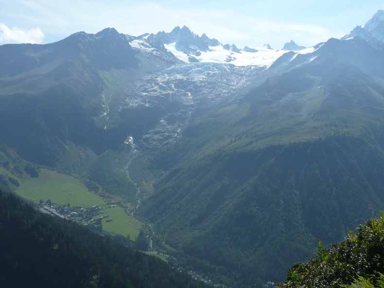
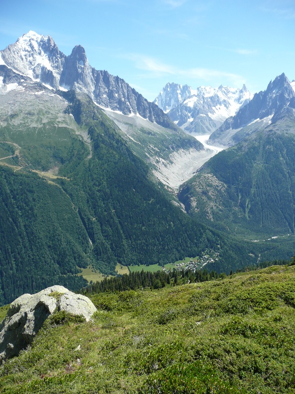
Within 30 minutes, you have a great view of the Tour and Argentière glaciers on one side and on the other the Vallorcine Valley.
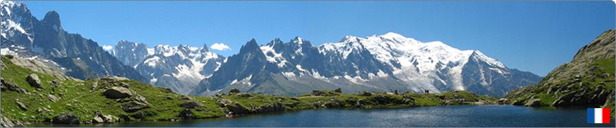
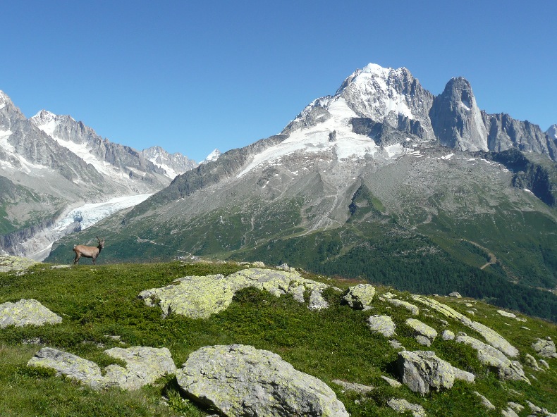
In 1h45, there is a 180° panorama on the Mont-Blanc and its mythical summits, Aiguille du Tour, Aiguille du Chardonnet, Aiguille Verte and the Drus.
In 2hrs, you will reach a fork where you leave the path towards Argentière / Flégère to follow that of Lac Blanc / Lacs des Chéserys. You are in the heart of the postcard, the view is always the same with the Jorasses and the Mont-Blanc to boot.
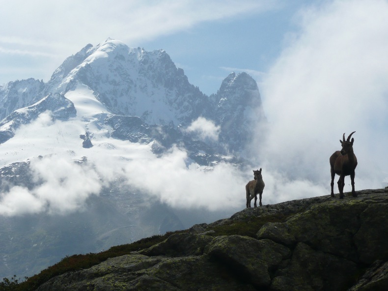
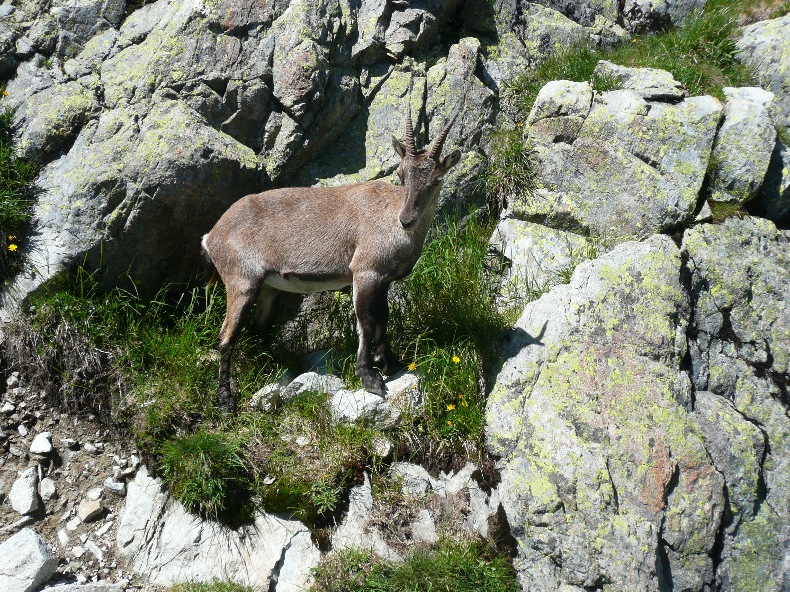
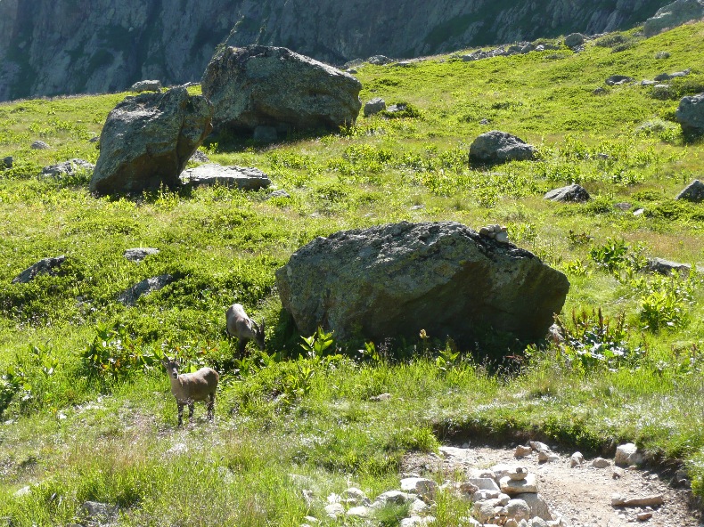
Ibex assured along the way.
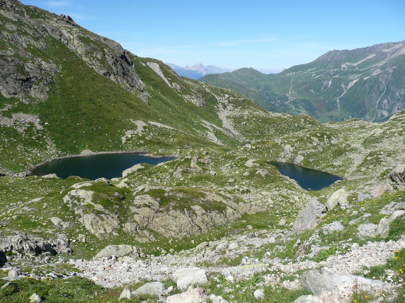
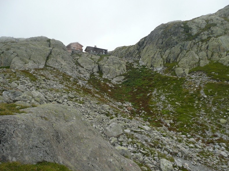
One can see the Chéserys lakes on the right, set on a wide terrace that stretches halfway up the Aiguilles Rouges. The path leads down to the southern shores of the Chéserys lake. From the lake, one can see among the overhanging rocks, the Lac Blanc refuge and the rest of the route.
One joins the shelter within 20 minutes after the last climb, taking a short and easy way that enables to cross rock aplomb.
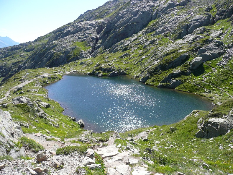
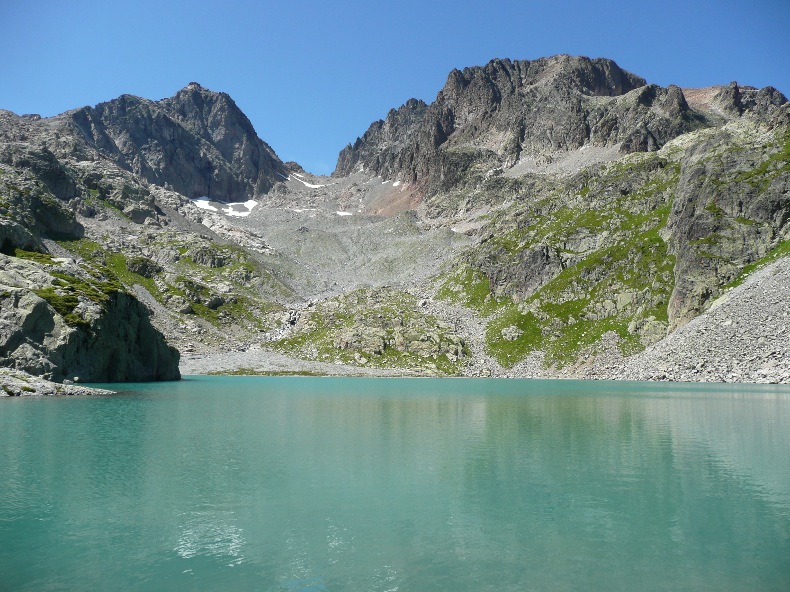
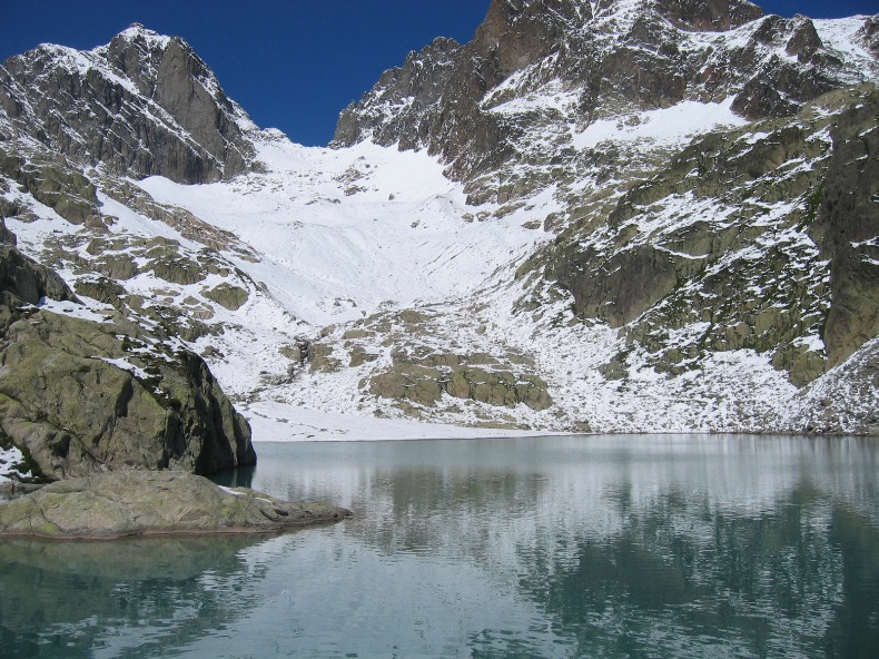
In the summer, the thawed Lac Blanc (actually two joined glacial lakes) is turquoise in colour. Keep to the right of the first lake for a picnic on the shores of the second lake, which is quieter. Some brave take a (quick!) bath in the lake. The yellow-billed choughs (large crows) watch out for the crumbs.
Go back on your steps and turn to the right of the refuge where a path is signposted “L’Index”. You reach the top of the Index chairlift in one hour by an overhanging path, still with an extraordinary panorama of the Mont-Blanc.
Take the chairlift and cable car downhill from la Flégère to return to the parking lot.
From the Lac Blanc, I do not recommend the direct return by the path signposted “La Flégère” (1h10) which is a true hikers highway in both directions (up and down from the cable car of La Flégère to Lac Blanc). For those who would do this hike outside peak season and when the bus to the Col des Montets still works, or for those not wishing to use the cable car or chairlifts (Index/ la Flégère), for the return journey from the Lac Blanc, you can return to the Col des Montets by the same route (2h10) or by Tré-les-Champs (2h10 up to Tré-les-Champs).
The return by Tré-les-Champs follows the same path from the Lac Blanc and then at the level of the Chéserys lakes, ignore the path taken on the way up on the left (towards the Col des Montets) and take the one to the right towards Tré-les-Champs. At the level of the Aiguillette d’Argentière (1,893 m), you go over granite cliffs thanks to a passage (a handrail on the rock and 2 ladders). Continue the descent through a larch forest towards Plan de la Grange and Tré-le-Champ-le-Haut. The path on the left joins the reception chalet of the Col des Montets.
© All reproduction prohibited.